The City of Arts and Sciences, rebuilt for one golden hour
A 103-second drone flythrough of Santiago Calatrava and Félix Candela's Ciutat de les Arts i les Ciències, along the old Turia riverbed. No drone flew: every building, pool, palm and ray of low sun in the film was modelled from maps, aerial surveys and photographs, and rendered frame by frame.
Fly it yourself
The same model in real time in your browser: steer with W A S D and the mouse, jump to the film's seven viewpoints, slide from golden hour to sunset. It uses the film's own sky, haze and colour, with the light baked from the same renderer. Needs a desktop computer with a recent graphics card; about 90 MB to load.
 Open the fly-through →
Eight stills
Eight moments from the film, rendered again as single images with extra samples. Select one to enlarge it.
Which building is which
The complex runs for about a kilometre from north-west to south-east. Footprints, pools and streets on this map come from OpenStreetMap, the same survey data the model was built on.
- 1Palau de les Arts Reina SofíaOpera house: two tiled shells under a 230 m plume. Calatrava, 2005.
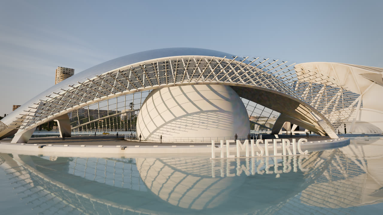
- 2L'HemisfèricPlanetarium and IMAX dome shaped like an eye; its glazed lids open. Calatrava, 1998.
- 3Museu de les CiènciesThe long white ribbed science museum. Calatrava, 2000.
- 4L'UmbracleA garden walk under 55 fixed and 54 floating arches. Calatrava, 2000.
- 5Pont de l'Assut de l'OrThe harp bridge: 29 stays from a curved 125 m mast. Calatrava, 2008.
- 6L'ÀgoraThe blue-tiled pointed hall, now CaixaForum. Calatrava, 2009.
- 7L'OceanogràficThin concrete shells like a water lily. Félix Candela, 2003.
- 8Reflecting poolsShallow turquoise water, white trencadís mosaic and promenades.
How it was made
Modelled procedurally in Python inside Blender 5.1.2 and path-traced with Cycles on rented GPUs.
Research first
Site plans, footprints and about 13,700 surrounding city buildings came from OpenStreetMap. Spain's national aerial survey (PNOA) gave true top-down views, roof forms and the position of every tree. Dimensions, rib and arch counts were taken from official and architect sources and checked against photographs.
Built in code
Each structure is a Python script that generates its geometry: the Hemisfèric's lids, the Museu's 21 bays, the Umbracle's 109 arches and thousands of laths, the Palau's shells and plume, the bridge's 29 stays, Candela's hyperbolic paraboloids. Nothing was sculpted by hand, so every part can be regenerated and corrected.
Light and air
A physical sky with the sun sinking from about 12° to just above the horizon, a thin layer of haze over the whole city for aerial perspective, shallow pools that mirror the sky, and white broken-tile mosaic that glints as the camera moves. Rendered with Cycles, 64 samples per pixel, OptiX denoising and motion blur.
Checked against reality
Before the film was rendered, stills of every shot were compared side by side with real photographs by reviewers looking for anything that gave the game away: shapes, proportions, materials, light. The list of fixes was worked until nothing serious was left.
Sound
The soundtrack is ambience only: wind, water, palm fronds, evening birds and the distant city, generated with ElevenLabs sound effects and mixed to follow each shot. There is no music.
What it is not
This is a reconstruction, not a recording. It was made to look like drone footage, and it is not: details are simplified, people and traffic are invented, and the light of this particular evening never happened.